Future transport networks in Pukekohe, Paerata and south Drury
About Te Tupu Ngātahi Supporting Growth
Te Tupu Ngātahi Supporting Growth is responsible for investigating and planning more than 70 transport projects to support urban growth in Auckland over the next 30 years. We’re planning for future growth now, before new homes and communities are built.
Future transport projects will connect new communities, help people travel by safer, low-carbon ways and deliver essential infrastructure to future-proof the economy. We’re proud to be helping plan the transport infrastructure that will be needed to create safe, accessible and liveable communities for future Aucklanders.
Te Tupu Ngātahi Supporting Growth is a collaboration between Auckland Transport and Waka Kotahi NZ Transport Agency. We also work closely with Auckland Council and KiwiRail.
Manawhenua has a vital role as kaitiaki for Tāmaki Makaurau. We partner with Manawhenua to ensure Māori cultural values and perspectives are considered and integrated into our transport network plans.
Future growth in Pukekohe, Paerata and south Drury
South Auckland is growing fast and over the next 30 years, an additional 120,000 people are expected to live in Takaanini, Ōpāheke, Drury, Paerata, and Pukekohe.
By 2050 more than 65,000 people are expected to be living in Pukekohe, Paerata, and south Drury with around 12,500 new homes and 5000 new jobs expected as a result of this population increase. Areas of land across the Pukekohe, Paerata and south Drury have been zoned future urban to support planned business and residential growth.
Te Tupu Ngātahi Supporting Growth is working to protect land for modern, integrated, safe, and sustainable transport networks that will better connect future communities with options for walking, cycling, using public transport, and driving.
This work integrates with the Auckland Council Pukekohe-Paerata Structure Plan and Drury-Opaheke Structure plan and community aspirations that transport networks support the mix and location of housing, employment, retail, commercial, and communities in the area.
The timing for construction of the new transport network will vary and is dependent on the release of surrounding land for development and funding.
What are we proposing?
Please note: Routes are indicative only
Please be advised that the Pukekohe North East Arterial alignment has now been changed. This is due to ongoing assessment and the feedback we received during consultation.
The below map details the original preferred alignment.
| Future train station |
| Paerata Arterial |
| Future interchange (not in scope for Te Tupu Ngātahi Supporting Growth) |
| Pukekohe Arterials (North West, North East, and South West, and South East) |
| Bombay Interchange Upgrade (not in scope for Te Tupu Ngātahi Supporting Growth) | State Highways 1 and 22 | |
| North Island Main Trunk (existing rail line) |
| Mill Road (Bombay) - Pukekohe East Road Upgrade |
| Drury West Arterial and South Drury Connection |
| Future Urban Zone |
| State Highway 22 Connection and Drury-Paerata Link |
| Existing Pukekohe train station |
Ongoing transport projects improving Pukekohe-Paerata and south Drury
A number of transport projects are already underway or being planned in the area. Our programme will need to consider these projects, and work with them to transform transport for these communities. Projects include:
- Drury Arterials - Notices of Requirement lodged by Te Tupu Ngātahi.
- Papakura ki Pukekura - Papakura to Bombay (P2P) - part of a longer-term strategic transport network being investigated and delivered to support growth in South Auckland.
- SH22/SH1 Drury to Paerata - detailed design is underway, investigating improvements road safety on SH22 between the Drury turn off from SH1 and Paerata township.
- Three new rail stations in Drury, integrating with the P2P project. You can give feedback on two of the stations (at Drury West and Paerata) here.
- Auckland Transport and KiwiRail are also bringing electric trains to Pukekohe, with work currently underway.
Where are we heading?
We are working towards lodging our Notice of Requirement (NoR) documentation to protect the land we need. Once this is finalised it will be lodged with either Waka Kotahi or Auckland Transport as the requiring authorities. An important part of developing a NoR is consulting with those potentially affected – the community, Manawhenua, businesses, government and community organisations.
We’re working with Auckland Council to integrate our transport planning with Auckland Council’s land use aspirations for the Future Urban Zoned areas of Pukekohe, Paerata, and south Drury as outlined in the Pukekohe-Paerata Structure Plan.
FAQs
We don’t have a fixed timeframe yet and this work is still a number of years away. We expect that work could start in the next 20 to 30 years. Our project team is now identifying the land required for these future changes.
Following route protection, future project stages include concept design, resource consent approvals, procurement, detailed design and construction. For some projects, the time between route protection and construction is short, but in other projects it can be some years before construction begins.
No, these projects are not yet funded for construction. Funding will need to be secured at a later date.
A number of factors have contributed to a change in the projects being delivered in the Pukekohe, Paerata and south Drury since we last communicated with the community in 2020, these include:
- A shift in the current climate change context, including Resource Management Act reforms and the Climate Change Response (Zero Carbon) Amendment Act.
- Increased private development activity in the area.
- The changing way Aucklanders want to travel – with communities wanting more transport choices, including options for more sustainable transport modes.
There is now even more emphasis on reducing carbon emissions from road transport. The current emissions reduction plan aims to reduce light vehicle travel by 20% by 2035. This places significantly more scrutiny on any proposal to add cars (light vehicles) to existing road networks and investment in new roads prioritising travel by light vehicles. Carbon emissions emitted during construction activities is also a consideration we need to take into account.
This has led to a review of the future Pukekohe-Paerata and south Drury transport projects to determine their impact on future light vehicle kilometres travelled. In particular, the project previously referred to as the Pukekohe Expressway, a four-lane road with a higher speed limit, is now proposed to be predominantly a strategic urban arterial road with two-lanes and an urban speed limit.
The updated proposal for this route achieves largely the same transport outcomes around safety, access, integration, resilience, and travel choice, but without the same degree of encouragement to travel by car that an expressway may have. Our assessments found that a two-lane arterial road delivers benefits for essential freight journeys and other drivers, whilst also contributing to a shift to more walking, cycling and public transport; all of which will undergo transformational improvements in the years to come.
Over the past several years Pukekohe-Paerata and south Drury has already experienced growth and by 2050 there will be over:
- 65,000 people living in the Pukekohe-Paerata area
- 12,500 new houses
- 5,000 new jobs
It is important that future transport routes are planned for now to accommodate that growth.
 Package 1 – An upgrade to SH22 continuing with four lanes from Drury to Pukekohe
Package 2 – An upgrade to Mill Road and Pukekohe East Road, Bombay, from the Bombay interchange to Pukekohe
Package 3 – Upgrading the existing Burtt Road with a new connection to Paerata (two lanes with a reduced speed in the future urban zone)
Package 4 - A new tow lane connection between Drury and Paerata with slower speeds in the future urban zone and a connection to SH22.
Package 5 – A four lane expressway with high-speed limit
Which option is the preferred option?
Package 4 was identified as the preferred option because it had a smaller footprint and therefore had a reduced effect on flooding, ecology and visual amenity issues. The smaller footprint also has reduced property impacts and integrates better with future urban areas providing better public transport, walking, and cycling facilities.
The scale of expected population growth and travel demand in and around Pukekohe and Paerata in the next 25 to 30 years means that the existing road network would not cope. Residential development is proposed adjacent to State Highway 22 in Paerata and significant growth is occurring and planned in Drury. Significant investment in new transport corridors and upgrades to existing infrastructure and services is needed to support this growth and relieve pressure on the existing state highway network.
A transport network that only provides for people driving cars is not the future that communities see for Tāmaki Makaurau. We are planning now so that future generations have genuine options for how they travel around their community.
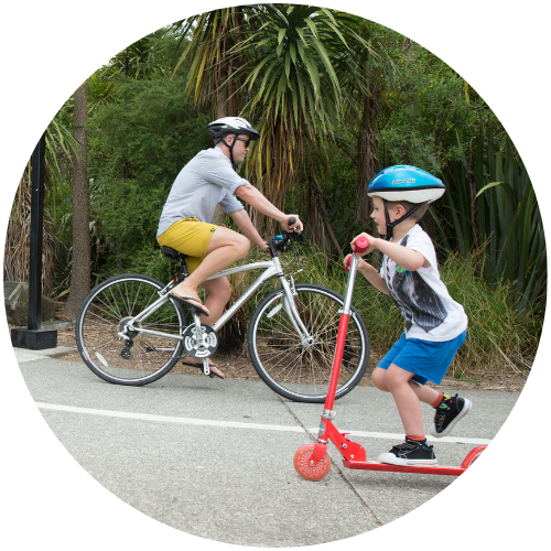
A shift to more sustainable transport modes, especially walking and cycling, is needed to take action on climate change and to achieve a zero-carbon transport network. We know that better footpaths and dedicated cycling facilities encourages people to walk and cycle, especially for local trips.
We are seeking public feedback on the proposed plan to improve future transport networks in Pukekohe, Paerata, and south Drury until 20 December 2022.
We have held community open days on Saturday 12 November, and Saturday 3 December.
However, this is not your only chance to let us know your feedback, there will be more opportunities in the early part of 2023 as we further refine the options.


